
Follow a Lebanon Street Directory Address
For a named Lebanon street, first locate the physical address in the Warren County Auditor record. The Lebanon result supplies a parcel number, a legal description, and a tax-record owner or entity. Next, place that parcel on the Lebanon city and county map. A Recorder search can then connect the parcel to recorded conveyances. This sequence distinguishes land records from household evidence and avoids treating one source as a complete residents list.
- Open the Warren County Auditor Property Search and select Address. Save the parcel number, situs address, legal description, subdivision or lot details, and current tax-record owner.
- Use the Lebanon Parcel Public Access map to read Address Points, Road Centerlines, OwnerParcel, municipal-boundary, and building-footprint context.
- Enter the ten-digit parcel number or a name in the Lebanon Recorder's AVA route. Compare the latest deed's parties and legal description with the Auditor record.
- For an already known person, Ohio Voter Search can help confirm a permitted registration record after a first name, last name, and Warren County are supplied. It does not browse a street.
- For an older Lebanon question, ask WCGS or Harmon whether a dated alphabetical, telephone, or reverse directory exists, then corroborate the clue with tax, deed, census, or newspaper evidence.
That is a street-by-street method, not a claim that one page proves who occupies every parcel. The Past Residents page follows the longer backward trail when a single address needs an era-by-era history.
Lebanon Street Records Begin With a Parcel
The Auditor search is Lebanon's reliable handoff from a street address to a stable land identifier. Its entry screen offers Name, Address, Parcel ID, Account Number, Subdivision or Lot, and Advanced Search modes. Use one criterion at a time. The local parcel schema separates OWNER_NAME and MAIL_NAME from physical address fields, a useful distinction when a tax-contact address is outside the property.
| Lebanon Auditor field or mode | How it is used | Lebanon street-directory boundary |
|---|---|---|
| Name | Finds a current Lebanon tax record by owner or entity name. | A listed owner is not automatically the person at the situs address. |
| Address | Starts with the Lebanon physical street-address route. | It identifies a parcel, not every person connected to it. |
| Parcel ID | Provides the Lebanon Recorder's recommended ten-digit handoff. | Use it with the legal description when numbers or labels vary. |
| Account Number | Opens a Lebanon account-specific property route. | It is a tax-record identifier, not a household identifier. |
| Subdivision or Lot | Helps with Lebanon platted property and older deed matching. | Confirm against the recorded legal description. |
The Warren County parcel feature service illustrates the fields behind a Lebanon address search.
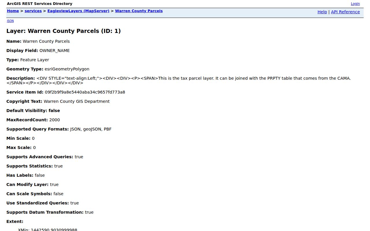
Those separate situs, mailing, parcel, lot, book, page, and legal-description fields explain why a street directory should not turn a mailing contact into an occupancy claim.
Read Lebanon Street Directory Map Layers
Map layers make a Lebanon street segment legible before a record request is made. The public parcel service includes Address Points, Road Centerlines, OwnerParcel, water features, building footprints, Lebanon Corporation, municipal boundaries, and FEMA flood-zone context. Road Centerlines also retain left and right address ranges plus city and ZIP attributes. That matters where one road side is near a city or postal edge.
The map is geographic context. It can show parcel shape, a neighboring polygon, or a Lebanon address range, but it does not establish a deed chain or identify a current household. Return to the Lebanon Auditor for current tax data and to the Recorder for recorded documents.
The Lebanon parcel map layers show the local geographic choices available for an address search.
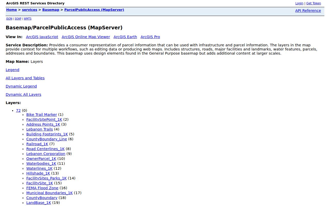
Use the displayed Lebanon street, parcel, and boundary layers to form a narrow property question, then seek the record from the office that maintains it.
Lebanon Street Directory Record Coverage
Address-keyed sources each answer a limited Lebanon question. The county's current property roll gives the strongest parcel starting point. GIS adds street geometry. The Recorder provides recorded transaction history, while archives and local repositories supply older context. A City permit or zoning file can be requested by physical address and approximate date, but no verified public online Lebanon permit or code-case search was found.
| Lebanon address source | Custodian or access route | What it can contribute | Important limit |
|---|---|---|---|
| Current property roll | Lebanon-area Warren County Auditor | Tax-record owner, parcel, situs and mailing fields, legal description, class and use. | Current property data is not a complete resident roll. |
| Parcel and road map | Warren County GIS and Lebanon city service | Parcel geometry, address points, roads, city limit, and boundary context. | Map geometry does not prove title or occupancy. |
| Deed and lien index | Warren County Recorder AVA for Lebanon parcels | Grantor, grantee, instrument trail, and legal description. | A document party has a recorded role, not a current-residence finding. |
| Historic tax and court material | Records Center in Lebanon and WCGS | Tax duplicates, estate clues, and archival county material. | Tax duplicates begin in 1809 and have gaps. |
| Permit or zoning file | Lebanon Community Development request | Lebanon address, work, applicant, and timing evidence where responsive records exist. | Ask narrowly by address, date, and record type. |
When a name rather than a street becomes the central question, use the separate Resident Lookup workflow to compare record-specific evidence instead of expanding a street search beyond what the records support.
Trace Lebanon Streets Through Recorder Deeds
The Lebanon Recorder's instructions give a clear local chain. Obtain the ten-digit parcel number from the Auditor address or name search, then use AVA's parcel-number or name route. Find the most recent recorded transfer, save its document date, parties, and legal-description wording, and use the seller or grantor as the next historical name to examine. Match the same parcel lineage, lot, subdivision, or legal description rather than relying only on a familiar street number.
A grantor transfers an interest. A grantee receives one. A deed may document a transfer, but a quitclaim, fiduciary deed, affidavit, mortgage release, or estate-related instrument is not necessarily a sale. The Recorder says deeds are indexed online through 1797 and says most documents were findable online after April 20, 2016. The local guide's statement that land records run from 1799 should be confirmed with the office for late-eighteenth-century coverage.
The Warren County Recorder search instructions show the parcel-first approach and document-printing route.
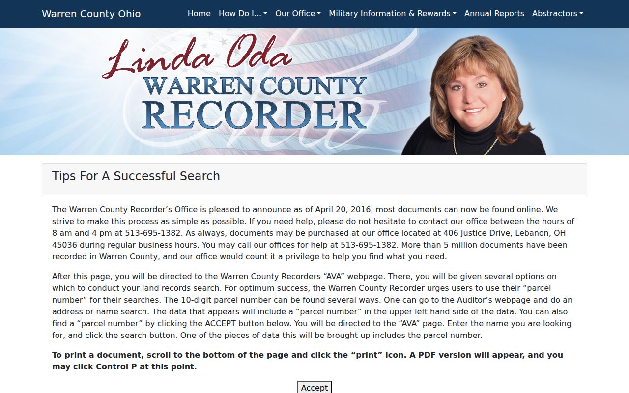
When Lebanon scans or indexing leave a gap, call the Recorder at 513-695-1382 or use the counter rather than guessing about a missing instrument.
Define Lebanon Street Record Terms
Old street labels can change while the land trail remains continuous. These terms keep a Lebanon address search tied to the record actually being compared.
- Parcel
- A tax and mapping unit of land identified by the county. The ten-digit Lebanon parcel number connects the Auditor record to the Recorder search.
- Situs address
- The Lebanon physical location of the parcel. It is separate from the tax mailing address and should not be read as proof of a person's presence.
- Plat
- A recorded map that lays out lots, blocks, or subdivisions. It can help bridge a later Lebanon street label to the legal land description.
- Criss-cross directory
- A reverse or street-address section in a historical directory, if the specific local volume includes one. Ask WCGS or Harmon to verify a year and title.
Lebanon research did not verify a citywide renumbering date or a named street-change year. Preserve the original address spelling and crosswalk it through plats, legal descriptions, road maps, and tax duplicates instead of assuming a simple number conversion.
Check Lebanon Street and ZIP Edges
Lebanon's core postal ZIP is 45036, but postal geography and the incorporated city do not use the same boundary. The 45036 ZCTA counted 41,060 people in 2020, while the City of Lebanon counted 20,841 that year. A street result labeled Lebanon can therefore need city-boundary and parcel verification before it is treated as a municipal record.
Lebanon Road Centerlines store left and right address ranges as well as side-specific city and ZIP fields. Check the physical address with the USPS ZIP Lookup, then use the parcel and municipal-boundary layers for the local record context. USPS itself says its result does not verify that a person or company is at an address.
Find Older Lebanon Street Listings
For a historical Lebanon street directory clue, WCGS is the first specialist stop. It lists City Directories as a research category, but its public inventory is under construction, so exact Lebanon years and reverse-directory runs must be confirmed at the desk. WCGS is open weekdays from 9 to 4 in the lower level at 406 Justice Drive and also offers FamilySearch Affiliate Library access.
Lebanon's Harmon Museum Mary W. Klei Research Library has atlases, local newspapers, tax and court material, photos, and family files. The Records Center in Lebanon preserves older county records in paper, electronic, and microfilm forms. Its material that is at least 75 years old is researchable there, while newer records are requested from the originating department. These local stops are better fallbacks than assuming every street source has been digitized.
The Western Star gives Lebanon a second historical trail. It ran from 1807 to 2013, and its Ohio Memory project provides 178,510 pages in 9,909 issues, with some gaps. Search street, house, surname, business, and title variants, then corroborate a useful Lebanon find with an official land, tax, census, or vital record.
Use Lebanon Property Fraud Alerts
Property records are also a consumer-safety concern. Warren County's Recorder offers a free Property Fraud Alert program that monitors land-record activity and can notify an enrollee by email, text, or phone. Spanish support is available, and people without computer access can enroll by calling 513-695-1382. An alert is a prompt to examine a recorded event, not proof that a transfer is fraudulent.
The Warren County Recorder property-fraud alert page is the source shown here.
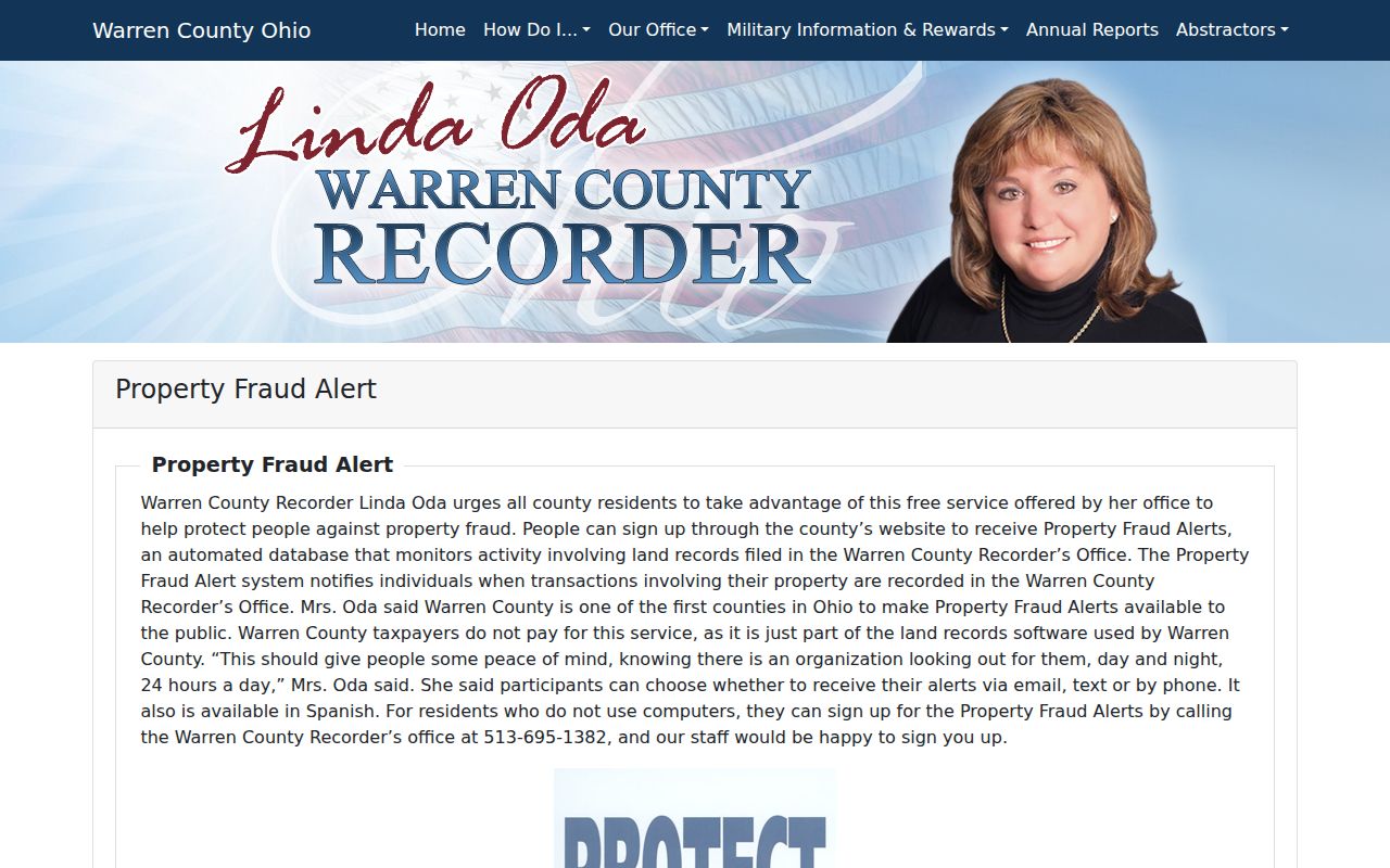
The service fits the Lebanon street-records process because it directs attention back to the Lebanon Recorder's official land-record evidence.
Know Lebanon Street Directory Limits
A public parcel or deed record does not reveal everyone at an address. Property and GIS data do not list every household member, and an Ohio voter search requires a known first name, last name, and county rather than offering a street roster. Utility accounts, postal delivery data, DMV address records, and protected voter information are not public address-search fallbacks. A missing result is not evidence that someone does not live there.
Lawful use. Lebanon street and parcel records are for personal, lawful research, property history, family history, and civic questions. Never use an address result to stalk, harass, intimidate, or harm another person.
Safe at Home Ohio protects eligible participants through substitute addresses and confidential voting options. Do not try to reconstruct a protected address from parcel, voter, or map records. Under ORC 149.43, custodians may release nonexempt portions of a record while redacting protected information.